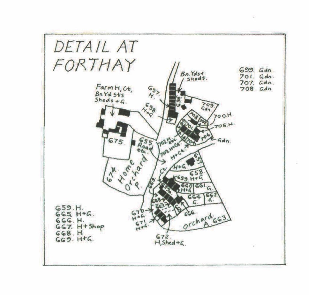
Section of the 1847 Tithe Apportionment Map, transcribed and reproduced with the kind permission of Geoff Gwatkin
659, 659a, 660 and 661 were owned by John Wight. They were subdivided so that James Spencer rented 659 and 659a (a house and court). George Cornock rented 660 (a house and garden). In the 1841 Census, he is listed as a baker, living with Martha. Both are age 50. Also in the household is Timothy Hill, aged 25, an agricultural labourer. Daniel Chappell rented 661, a garden.
Eli Mason lived in 698, the present-day Forthay House. In the 1841 Census, he is listed as a farmer, aged 40, living with Mary (35), Fanny (9), Mary (6), Edward (4), Samuel (2) and Eli (6 months). 697 is owned by him, and rented to William Powell.
The group of houses and gardens numbered from 699 to 708, were leased by Eli Mason from the Earl of Berkeley. He further leased them to various tenants.
700 was leased by ? Ponting, 702 by Eunice Philpott. In the 1841 Census ‘Unice’. aged 50, a charwoman, was living with Matilda, aged 20, Rachel, 15, and Emma, 11.
703 was leased by Thomas Carpenter. In ’41, he is listed as being an agricultural labourer, aged 40. In the same household are Elizabeth, 35, George, 13, Mary, 8, Thomas 5, Richard, 3, and ‘not known’ who was 11 days old.
704 was let to Charles Povey. 705, Joseph Brinkworth.
667 and 668 were owned and occupied by Thomas Shipway.
665 and 666 were owned by Daniel Cook. The former was rented to George Cornock and the latter by Elizabeth Clark. Six years previously, in 1841, it had been occupied by Henry Clark, a 40-year-old agricultural labourer, Elizabeth, aged 40, Lewis, 14, Hannah, 8, Mary, 4, and John, 1.
669, 670, 671 and 672 were owned by Henry Bailey. 669 was occupied by Morris Organ. In 1841, Maurice, aged 35 and an agricultural labourer, was living with Mary, aged 30, Rowland, 12, Caroline, 9, Mark, 6, and Emma, aged 6 months.
670 was occupied by Elizabeth Hancock. Aged 60 in ’41, she was living with John, aged 30 and an agricultural labourer, and Sarah, aged 20.
671 was occupied by Abraham Tilley. Recorded as a woollen spinner and age 40 in ’41, he lived with Hannah (35), Samuel (15), John (15, Joseph (14), Elizabeth (12), Ann (8), Mary (5), Eliza (3) and Emma (1).
672 was occupied by Cornelius Allen, a butcher, and 50 years old in the ’41 Census. In the same household are Ester Cole, aged 40, and Samuel Cole, aged 15.
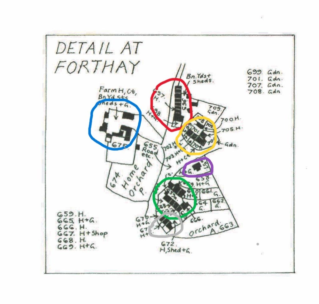
In 1762, 75 years earlier, most of the buildings were there, but had not been subdivided. The terrace circled in grey had not been built. Circled in green was one house and orchard, with the same footprint, owned by The Earl of Berkeley, and let to Mr Bearpacker senior. Yellow encircles what was a house and garden, again owned by the Earl of Berkeley, and let by Adam Perrett. Red delineates a house and garden, owned and occupied by Mrs Thomson. Purple outlines a house owned by the Earl of Berkeley, and let by George Nelmes. Blue outlines Hunts Court Farm, which, not being owned by the Berkeley Estate, is not detailed on the 1762 Map.

Reproduced with the permission of the National Library of Scotland
By 1924, the most remarkable change is the disappearance of the group of houses next to Forthay House, and number 669, Perhaps related to the story of Elinor Ponting.
It can also be seen that, post Enclosure, sections of the road have been incorporated into adjacent properties, notably in front of the terrace 670-672, called Horses Green in the 19th Century.
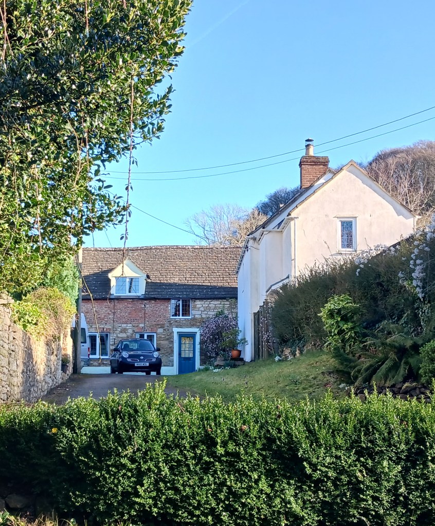
Looking up to number 2, Forthay (666 on the Tithe Map). The Chimes, on the right, replaces the terrace previously on the right.
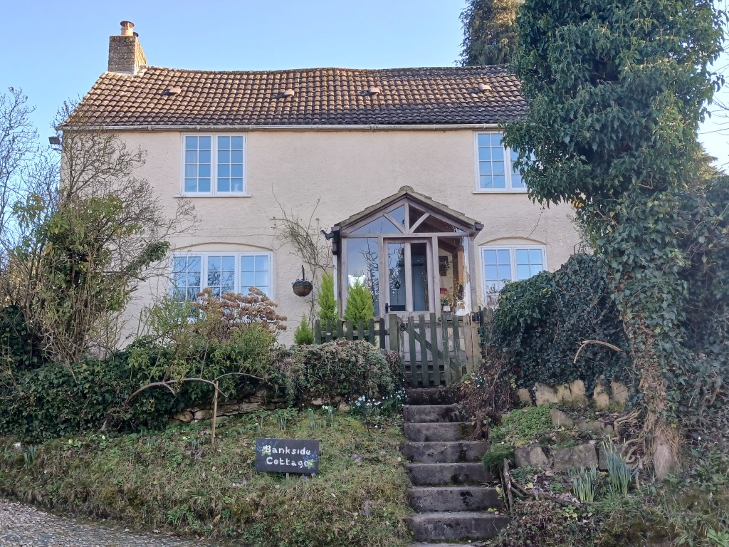
Bankside Cottage (657 on the Tithe Map)
